2008-10-20 / TYC 1313-01638-1 / (590) Tomyris
| # | OBS | Observer | Occ | Meth. | Instr. | CC | TSRC | UT1 | UT2 | UT3 | UT4 | UT2E | UT3E | Dur. | Chrd |
|---|---|---|---|---|---|---|---|---|---|---|---|---|---|---|---|
| 1 | show | Libor Smid | O+ | VID | M355 | CZ | RAD++ | 03:34:00 | 03:37:18.48 | 03:37:27.32 | 03:41:00 | 0.08 | 0.08 | 8.84 | 31.8 |
| 2 | show | F. Van Den Abbeel | O+ | CCD | M200 | BE | GPS++ | 03:33:02 | 03:34:30.46 | 03:34:37.26 | 03:36:03 | 0.20 | 0.60 | 6.80 | 24.5 |
| 3 | show | Jan Manek | O- | VID | M203 | CZ | 03:35:30 | 03:40:05 | |||||||
| 4 | show | Oliver Kloes | O- | VID | M254 | DE | 03:31:48 | 03:39:00 | |||||||
| 5 | show | Jean Lecacheux | O- | VID | M212 | FR | 03:23:01 | 03:43:01 | |||||||
| 6 | show | Rene Bourtembourg | O- | VIS | M254 | BE | 03:32:00 | 03:36:30 | |||||||
| 7 | show | Tomas Janik | O- | VIS | M254 | CZ | 03:37:08 | 03:39:01 | |||||||
| 8 | show | T. Pauwels et al | O- | CCD | M850 | BE | 03:10:44 | 03:43:18 | |||||||
| 9 | show | Wolfgang Rothe | O- | VID | M200 | DE | 03:33:36 | 03:43:09 |
9 observations found in db: euraster
Available (probably) matching predictions (click on the link to switch):| JPL#63 : 05a16c40-4e20-4a2f-9895-a7f489142d45 [db: observed] |
| JPL#63 : 92b9e470-bf7c-4914-8ae3-9a553bc517db [db: observed] |
| JPL#63 : 1710b825-5060-497e-bfc3-44a6dfa9c01c [db: observed] |
Using prediction 05a16c40-4e20-4a2f-9895-a7f489142d45 for map and profile fit
| Ellipse and circular profile fits to the timings (chords) |
|---|
|
|
Auto-Fit Result: X0,Y0 = 834.2, -1846.2 km Circular diameter = 38 km From 2 chords (VID,CCD) You can enter space separated chord numbers (example: 11 4 8) or a method like VIS to ignore all visual timings, or a time source like RAD and NTP (but not GPS). If the plot disappears, then there are less than 2 chords left (too much ignored, go back with browser). Check SiMDA for size and mass data. Check Johnston Archive for satellites. |
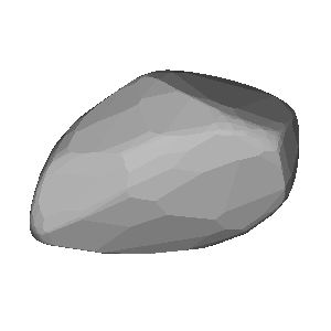
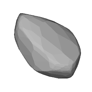
Sky projection (artificial light) for occ. time: 2008-10-20, 03:37 UT (JD = 2454759.651)
| DAMIT | Q | P (h) | λ, β | JD0 | JD-JD0 | φ0 | Version | Modified | Vol-equiv D | Cmnt |
|---|---|---|---|---|---|---|---|---|---|---|
| # 367 | 2.0 | 5.552 | 274°, -30° | 2.445323e6 | 9436.7 | 0.0° | None | 2017-04-03 | not scaled | 2017-03-31 |
| # 368 | 2.0 | 5.552 | 113°, -35° | 2.445323e6 | 9436.7 | 0.0° | None | 2017-04-03 | not scaled | 2017-03-31 |


Image size: 300px. Transparent image background for copy & paste
| Map with groundtrack and observer stations |
|---|
| Event Details |
|---|
Occultation UUID [and DB] : 05a16c40-4e20-4a2f-9895-a7f489142d45 [observed] Occultation Date + Time : 2008-10-20 at 03:31:34 UT +/- 0.09 min [1] Object Designation : (590) Tomyris Orbit Class : MBA Star Designation : GDR3 3348575207995261312 Star Coordinates (ICRF) : RA = 06 02 40.2308, DE = +15 20 38.784 [2] Star Magnitudes : G = 15.05 mag, RP = 20.11 mag, BP = 20.51 mag Object Magnitude : V = 14.98 mag Estimated Magnitude Drop : 0.7 mag Estimated Max. Duration : 11.0 sec Object Mean Diameter : 40 km (src: astorb) Speed of the shadow : 3.6 km/s Elongation to Moon & Sun : 14° (sunlit = 65%), Sun = 116° Cross-track uncertainty : 5.9 mas = 9 km = 0.23 path-width (1-sig) RUWE and duplicate source : 1.0 mas, dup.src = 0 (0:false, 1:true) Ephemeris Reference : JPL#63 [1] time t0 of closest geocentric approach c/a, [2] including proper motion until t0 |
| More Data and Informations |
|---|
(If error 404: link not valid which means no data available)
| Aladin Sky Atlas |
|---|
| Aladin Lite direct link (has Gaia overlay) |